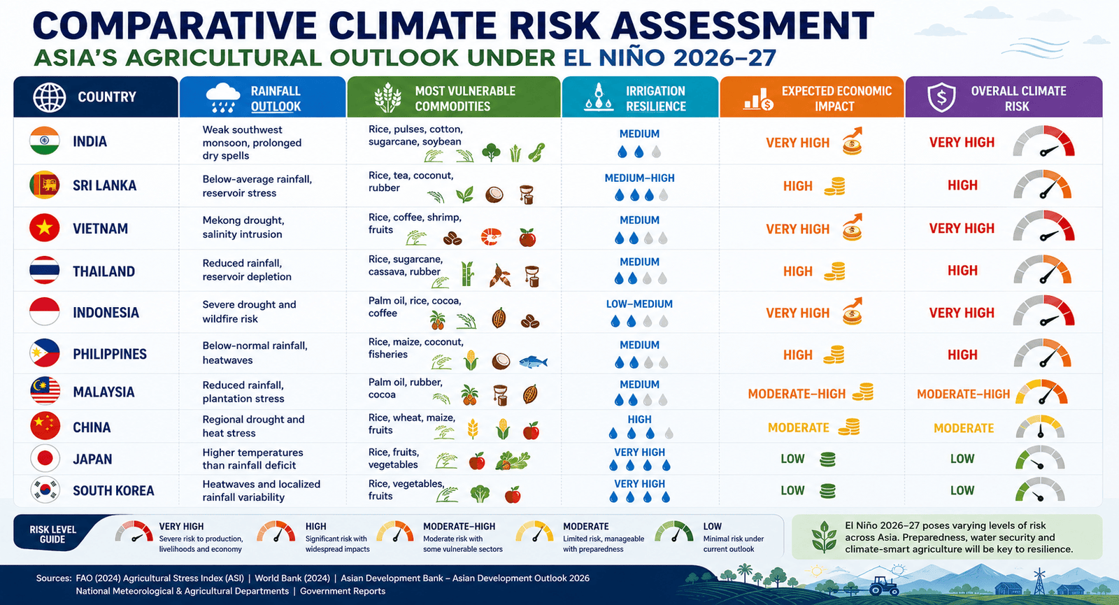
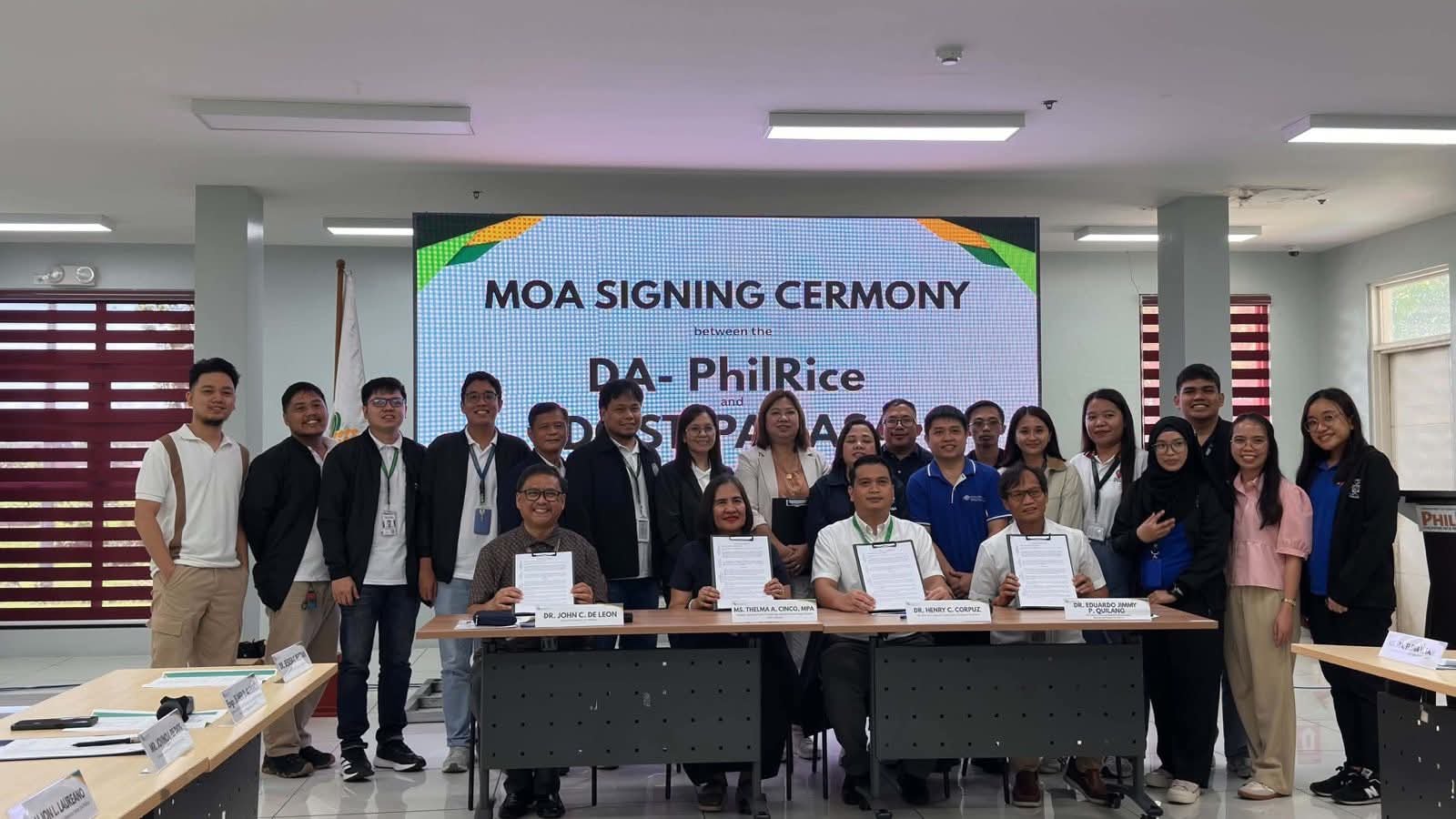
The Philippines is tightening the link between climate intelligence and rice production, as the Philippine Rice Research Institute (DA-PhilRice) and the Philippine Atmospheric, Geophysical and Astronomical Services Administration (PAGASA) establish a formal data-sharing partnership aimed at strengthening climate-resilient agricultural planning. The two government institutions signed a Memorandum of Agreement (MOA) on September 24, 2026, creating a framework for exchanging weather, climate and agricultural datasets to support rice monitoring, research, disaster risk reduction and climate-risk planning.
The agreement was signed by PAGASA Administrator Dr Nathaniel T. Servando, Weather Services Chief Thelma A. Cinco and DA-PhilRice Executive Director Dr John C. De Leon. Agriculture Secretary Francisco P. Tiu Laurel Jr. said the partnership forms part of the government’s broader effort to modernise agriculture through science, technology and data-driven decision-making.
Weather Intelligence Meets Rice Data
Under the agreement, PAGASA will provide DA-PhilRice with a range of weather and climate datasets, including gridded climate information such as ClimGridPh and access to its Ten-Day Weather Forecast API. The API provides available information on rainfall, minimum and maximum temperatures, wind speed and direction, cloud cover and humidity. Bringing these datasets together with rice production information could give planners a more detailed view of how weather conditions are affecting crops across locations and growth stages.
PAGASA will also provide geospatial and hazard-related information covering tropical cyclone tracks, rainfall advisories, affected provinces, drought and dry-spell assessments, soil moisture maps, rainfall forecasts and surface-temperature forecasts.
PhilRice Brings Rice-Growth Intelligence
The data exchange will work in both directions. DA-PhilRice will provide PAGASA with rice-area and planting-date maps derived from the Philippine Rice Information System (PRiSM), alongside rice growth-phase datasets and other agricultural geospatial information. The institute will also share rice-risk assessments, historical provincial rice production and yield data, and rice variety information where applicable.
The combination could help connect broad weather and hazard information with the actual location, growth stage and production characteristics of rice areas. That creates a stronger foundation for monitoring climate exposure at the farm and provincial levels, while potentially improving the timing and targeting of agricultural interventions.
Data Security Built Into the Partnership
The agreement also establishes safeguards around the use and handling of shared information. Data exchanged under the MOA will be used for research and development purposes and not for personal or commercial advantage. Raw API data, system credentials and proprietary datasets cannot be disclosed to third parties without prior written consent from the institution that originated the information.
The provisions are particularly relevant as government agencies increasingly rely on interconnected digital datasets for agricultural planning. The framework seeks to ensure that greater data availability does not come at the expense of institutional ownership, security or intellectual property.
Framework Runs Through 2028
The MOA took effect upon signing and will remain in force until December 2028, subject to provisions covering renewal, amendment and early termination. As climate variability increasingly complicates agricultural decision-making, the value of such systems will depend not simply on the amount of data available, but on how effectively weather information can be translated into timely, location-specific intelligence for rice production.