The remote sensing satellite will be used for land resources survey, urban planning, crop yield estimation, and disaster prevention and mitigation.
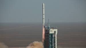
China successfully launched a new remote-sensing satellite of the Yaogan-34 series into space from the Jiuquan Satellite Launch Center in northwest China.
The Yaogan-34 03 satellite, carried by a Long March-4C rocket, successfully entered its planned orbit. This remote sensing satellite will be used in areas such as land resources survey, urban planning, crop yield estimation, and disaster prevention and mitigation. It was the 450th flight mission of the Long March carrier rocket series.